Crown and Thistle
The Crown & Thistle PH (public house) is shown on the 1865 OS map about 1/2 mile West of Rudchester, but it's not on any other available maps. It is not clear whether the pub was the whole of the Ironsign site or just the North East area. I'm not sute that this is technically in Rudchester... but I like the idea of having a Rudchester pub, so here it is.
Ironsign is recorded as the site of a former Inn on the Military Road by the Heddon-on-the-Wall Local History Society website, but I have not been able to find out any more about its history.
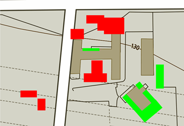
The buildings have evolved over the years with additions (shaded green) and demolitions (shown in red):
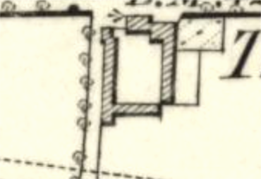
1865
Click here for a high resolution photograph in a new window:
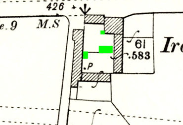
1897
Click here for a high resolution photograph in a new window:
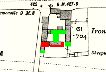
1919
Click here for a high resolution photograph in a new window:
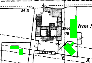
1963
Click here for a high resolution photograph in a new window:
2021
Click here for a high resolution photograph in a new window:
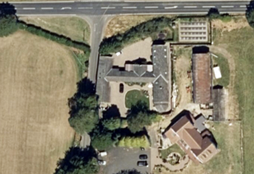
Apple aerial map 2021
Click here for a high resolution photograph in a new window: