Excavations 1997
An archaeological excavation and watching brief were carried out at Rudchester Farm, Northumberland (NZ 112 67 4) by The Archaeological Practice on behalf of Northumberland County Council in advance of the installation of an underground electricity cable. Details are available on the Archaeology Data Service website.
A 1 metre wide trench was excavated through the northern part of the farm to the electricity lines situated between the farm buildings and the southern fort rampart (figure 2 - see below). The trench immediately south of the electricity lines was machine-excavated by the electricity contractors due to safety constraints, with an archaeological watching brief. A series of pits and narrow linear features were uncovered in the northern part of the trench. Two of the pits were excavated, as they lay above the electricity cable's minimum prescribed depth. The rest were preserved in situ.
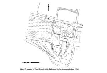
Location of Cable Trench (figure 2)
Click here for a high resolution scan in a new window:
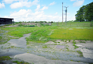
The site in 2025
Click here for a high resolution photograph in a new window:
Watching brief
Click here for the full pdf document in a new window:
The northern quarter of the trench showed closely-packed features of almost certain Roman date, presumably lying just beyond the fort ditch(es). The stone spread may represent later filling of the top of a fort ditch, and although the exposed width means that firm conclusions cannot be made, it is possible that cut might represent the southern edge of a large ditch. The subsoil dips down quite sharply where these features begin.
The southern three quarters of the trench shows only three archaeological features. Layers [03] and [23] appear to be relatively modern attempts to make up and level the ground, probably for expansion of the farm in this direction. It is quite possible, that the patch of cobbling and the charcoal spread are Roman. If so, while it would indicate some Roman activity in this part of the fort, the lack of later intrusions into these layers would question the presence of the Roman vicus under this part of the farm.